Randonnée Marche Mont Lozère et Goulet - Chasserades Bleymard  - Photo
 Roger Philippe Wallez
Roger Philippe Wallez

Utilisateur GUIDE

© OpenStreetMap contributors
Longueur
Longueur
20 km
Altitude max
Altitude max
1413 m
Dénivelé positif
Dénivelé positif
539 m
Km-Effort
Km-Effort  
28 km
Altitude min
Altitude min
1070 m
Dénivelé négatif
Dénivelé négatif
639 m
Boucle
Boucle
Non
Date de création :
2022-06-09 06:15:40.0
Dernière modification :
2022-06-09 13:15:25.185

(0 Avis)

Marche
Marche
6h57
Difficulté : Difficile

Scannez ce code QR pour ouvrir la randonnée dans l'application SityTrail

Application GPS de randonnée GRATUITE

Logo SityTrail SityTrail

IGN / Instituts géographiques

Télécharger SityTrail sur l'App Store Télécharger SityTrail sur Google Play

Logo SityTrail SityTrail World

Le monde est à vous

Télécharger SityTrail sur l'App Store Télécharger SityTrail sur Google Play Télécharger SityTrail sur Huawei AppGallery

À propos

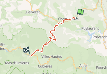
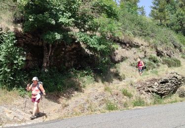
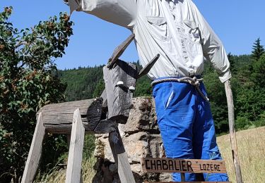
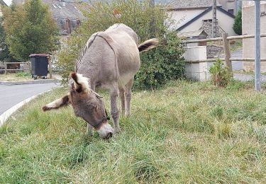
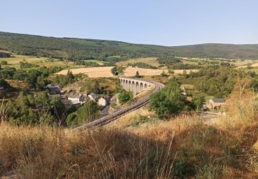
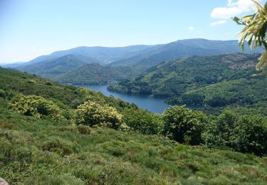
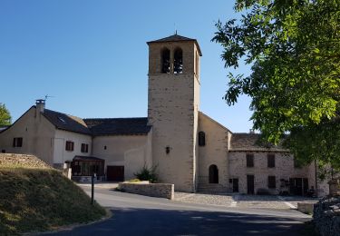
Randonnée Marche de 20 km à découvrir à Occitanie, Lozère, Mont Lozère et Goulet. Cette randonnée est proposée par Roger Philippe Wallez.

Profil altimétrique

Photos

Localisation

Pays :
France
Région :
Occitanie
Département/Province :
Lozère
Commune :
Mont Lozère et Goulet
Localité :
Chasseradès
Départ:(Dec)
Départ:(UTM)
567145 ; 4933646 (31T) N.

Randonnées à proximité

Randonnée Marche La Bastide-Puylaurent - la bastide saint Laurent _ Le Bleymard - Photo
Marche
MoulinPierrick

Marche

Difficile
(1)
La Bastide-Puylaurent, Occitanie, Lozère, France
33 km | 46 km-effort
6h 59min
Non
Randonnée Marche Mont Lozère et Goulet - Stevenson étape 7 - Photo
Marche
GUIDE
nadinebondoux

Marche

Difficile
Mont Lozère et Goulet, Occitanie, Lozère, France
20 km | 28 km-effort
4h 57min
Non
Randonnée Marche La Bastide-Puylaurent - Etape 5 Bastide Puy Laurent/ le Bleymard - Photo
Marche
Nathalie. Mercier

Marche

Difficile
La Bastide-Puylaurent, Occitanie, Lozère, France
30 km | 42 km-effort
7h 18min
Non
Randonnée Marche Mont Lozère et Goulet - le Bleymard  - Photo
Marche
jeanjean35

Marche

Très difficile
Mont Lozère et Goulet, Occitanie, Lozère, France
17,3 km | 25 km-effort
5h 14min
Non
Randonnée Marche La Bastide-Puylaurent - Chasséradès  - Photo
Marche
jeanjean35

Marche

Difficile
(1)
La Bastide-Puylaurent, Occitanie, Lozère, France
12 km | 16,8 km-effort
8h 54min
Non
Randonnée Marche Mont Lozère et Goulet - arsel chasserades au bleymard  - Photo
Marche
labarone

Marche

Très facile
Mont Lozère et Goulet, Occitanie, Lozère, France
14,1 km | 21 km-effort
6h 14min
Non
Randonnée V.T.T. Mont Lozère et Goulet - Chasserades Finiels 2020 - Photo
V.T.T.
JeanPierreNancy

V.T.T.

Difficile
Mont Lozère et Goulet, Occitanie, Lozère, France
48 km | 67 km-effort
5h 36min
Non
Randonnée Marche La Bastide-Puylaurent - de la bastide puylaurent à villefort gr700 - Photo
Marche
BrassensJC

Marche

Très difficile
La Bastide-Puylaurent, Occitanie, Lozère, France
25 km | 33 km-effort
7h 20min
Non
Randonnée Marche La Bastide-Puylaurent - E6 La Bastide Puylaurent - Les Alpiers GR70 - Photo
Marche
GUIDE
Kargil

Marche

Difficile
La Bastide-Puylaurent, Occitanie, Lozère, France
28 km | 39 km-effort
6h 56min
Non


Fermer
Mes abonnements